


Cottageville Voting District, Colleton County, South Carolina
About
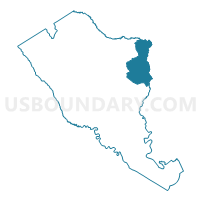
Outline

Summary
| Unique Area Identifier | 665518 |
| Name | Cottageville Voting District |
| County | Colleton County |
| State | South Carolina |
| Area (square miles) | 65.55 |
| Land Area (square miles) | 65.20 |
| Water Area (square miles) | 0.35 |
| % of Land Area | 99.46 |
| % of Water Area | 0.54 |
| Latitude of the Internal Point | 32.95024730 |
| Longtitude of the Internal Point | -80.45256120 |
Maps


Graphs
Select a template below for downloading or customizing gragh for Cottageville Voting District, Colleton County, South Carolina


Neighbors
Neighoring Voting District (by Name) Neighboring Voting District on the Map
- Delemars Voting District, Dorchester County, SC
- Givhans Voting District, Dorchester County, SC
- Givhans 2 Voting District, Dorchester County, SC
- Jacksonboro Voting District, Colleton County, SC
- Maple Cane Voting District, Colleton County, SC
- Mashawville Voting District, Colleton County, SC
- Ridgeville Voting District, Dorchester County, SC
- Rosses Voting District, Dorchester County, SC
- Round O Voting District, Colleton County, SC
Top 10 Neighboring County Subdivision (by Population) Neighboring County Subdivision on the Map
- Summerville CCD, Dorchester County, SC (117,093)
- Ridgeville CCD, Dorchester County, SC (6,066)
- Cottageville CCD, Colleton County, SC (5,894)
- Harleyville CCD, Dorchester County, SC (5,713)
- Green Pond CCD, Colleton County, SC (1,921)
Top 10 Neighboring Place (by Population) Neighboring Place on the Map
Top 10 Neighboring Unified School District (by Population) Neighboring Unified School District on the Map
- Dorchester School District 2, SC (119,266)
- Colleton County School District, SC (38,892)
- Dorchester School District 4, SC (17,289)
Top 10 Neighboring State Legislative District Lower Chamber (by Population) Neighboring State Legislative District Lower Chamber on the Map
- State House District 97, SC (42,529)
- State House District 116, SC (37,937)
- State House District 120, SC (33,404)
Top 10 Neighboring State Legislative District Upper Chamber (by Population) Neighboring State Legislative District Upper Chamber on the Map
- State Senate District 38, SC (132,422)
- State Senate District 37, SC (116,420)
- State Senate District 45, SC (92,424)
Top 10 Neighboring 111th Congressional District (by Population) Neighboring 111th Congressional District on the Map
Top 10 Neighboring Census Tract (by Population) Neighboring Census Tract on the Map
- Census Tract 104, Dorchester County, SC (6,066)
- Census Tract 9707, Colleton County, SC (5,894)
- Census Tract 103, Dorchester County, SC (5,713)
- Census Tract 108.01, Dorchester County, SC (5,162)
- Census Tract 9708, Colleton County, SC (1,921)